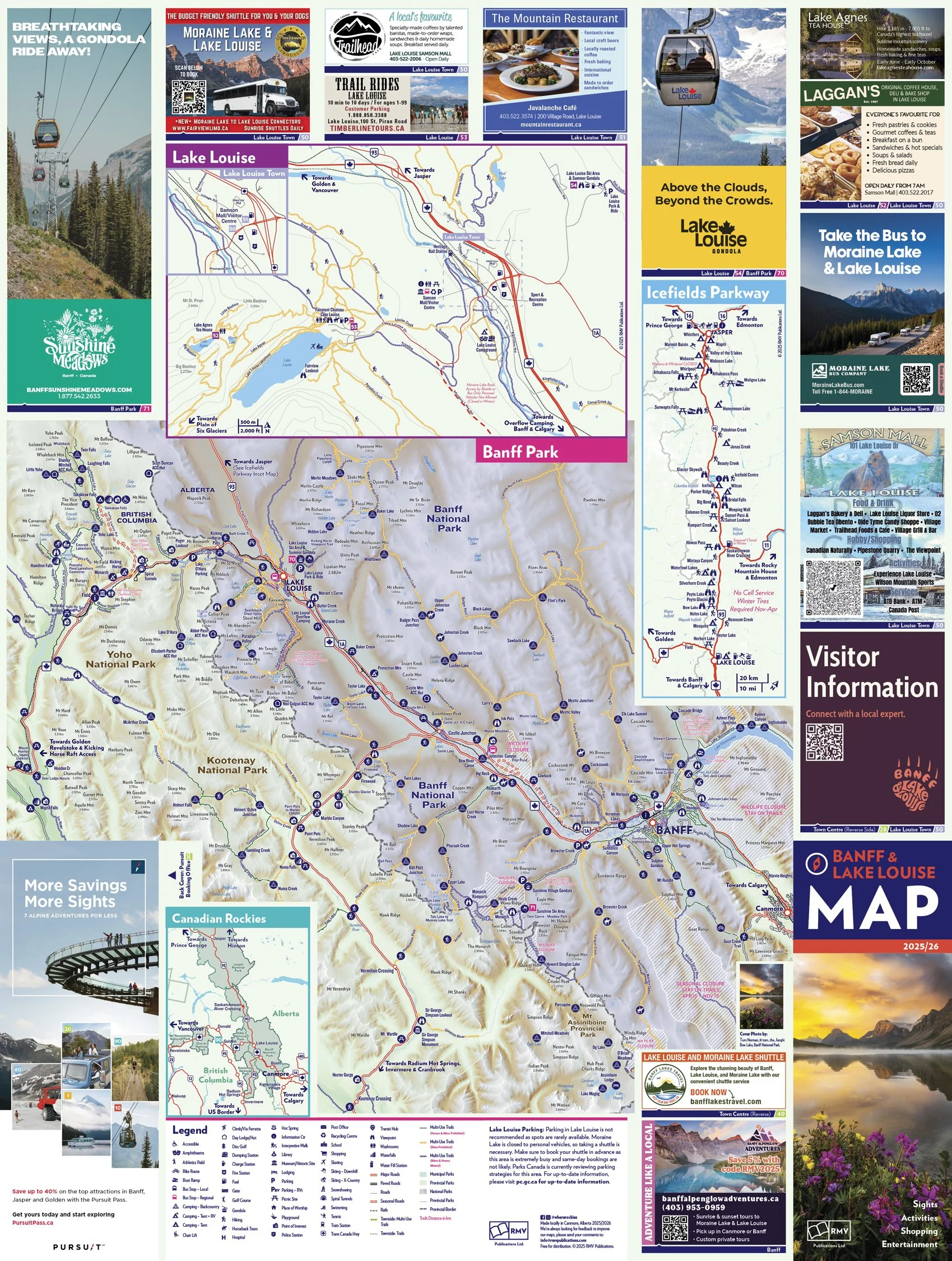
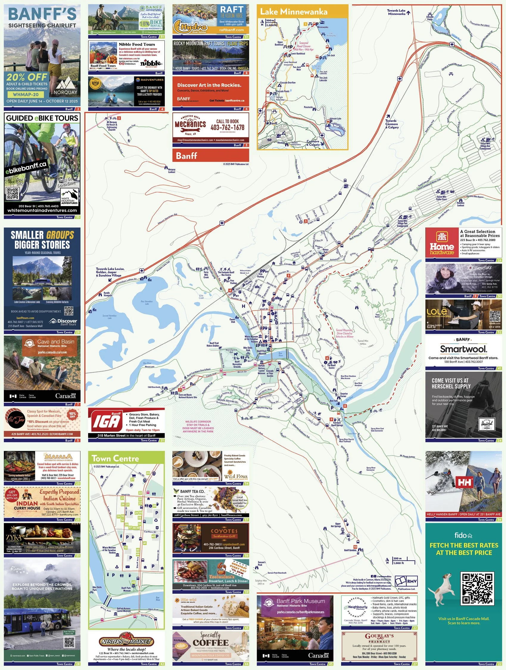
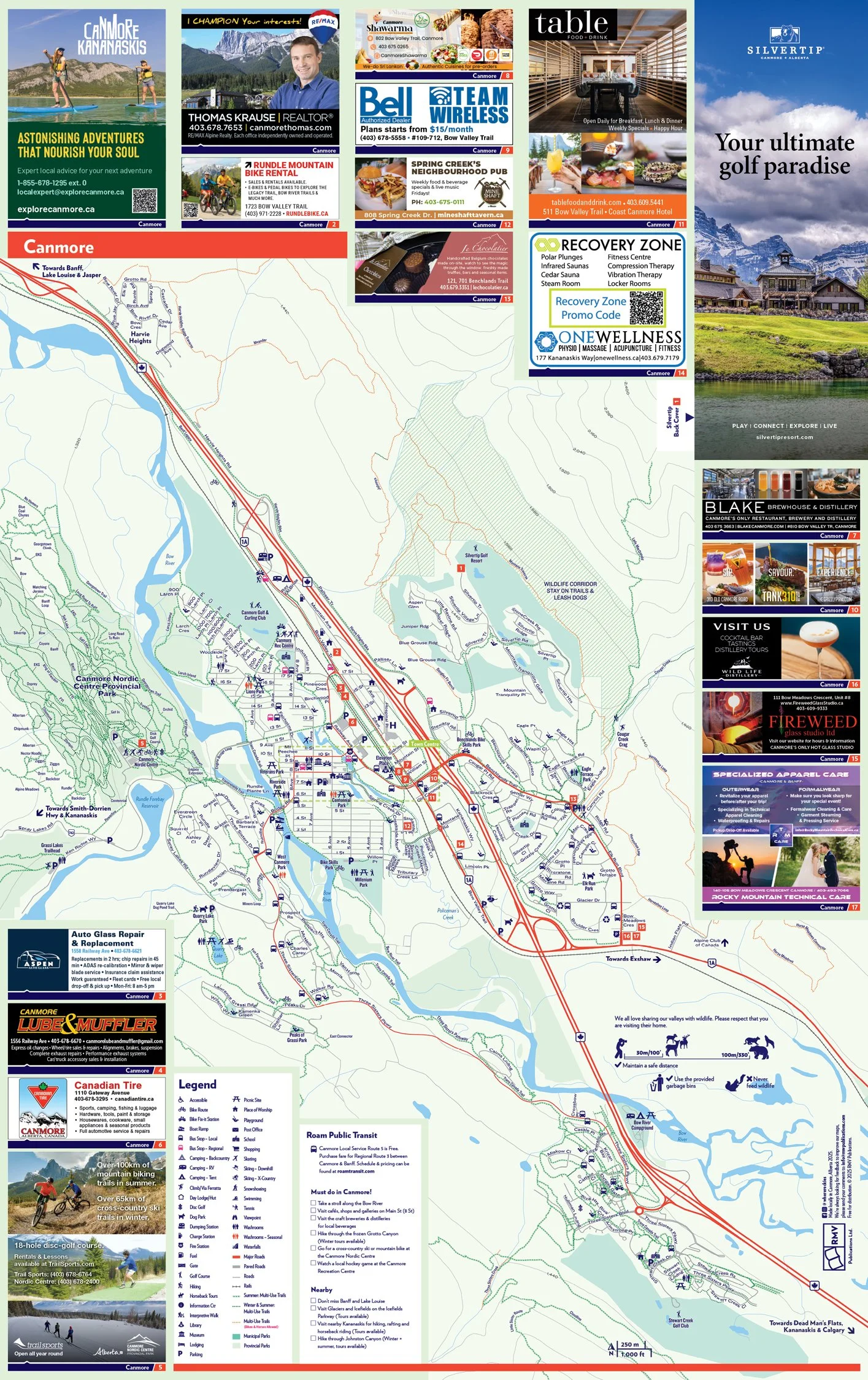
Tourism Maps
As a graphic designer at RMV Publications, I work at the intersection of cartography and visual storytelling to bring our tourism maps of the Canadian Rockies to life. This project showcases the process of designing our signature folding maps using GIS data, Adobe Illustrator, and MaPublisher—an essential workflow that allows us to combine geographic precision with high-quality print design.
RMV Publications has long been a leading producer of folding maps in the Rockies region, relied on by travellers, tourism bureaus, and local businesses alike. Our maps are trusted tools for exploring Canada's mountain parks and communities—distributed widely at hotels, visitor centres, car rental desks, attractions, and more. They’re designed not just to inform, but to guide real journeys: by car, on foot, bike, canoe, or skis.
Using GIS data as a base layer ensures that our maps are accurate to scale and rich with topographic detail. With MaPublisher integrated into Illustrator, we’re able to maintain this accuracy while applying our visual design system—organizing and styling layers like roads, waterways, trails, viewpoints, campgrounds, and landmarks with clarity and intent. The final product is printed in full colour on heavyweight glossy stock and folded in an accordion or Z-fold layout, making it both rugged and user-friendly for travellers on the go.
Designing these maps means balancing aesthetics with function, and data with design. It’s about making something beautiful that people will actually use—and keep. At RMV, that’s always been the goal.